Image
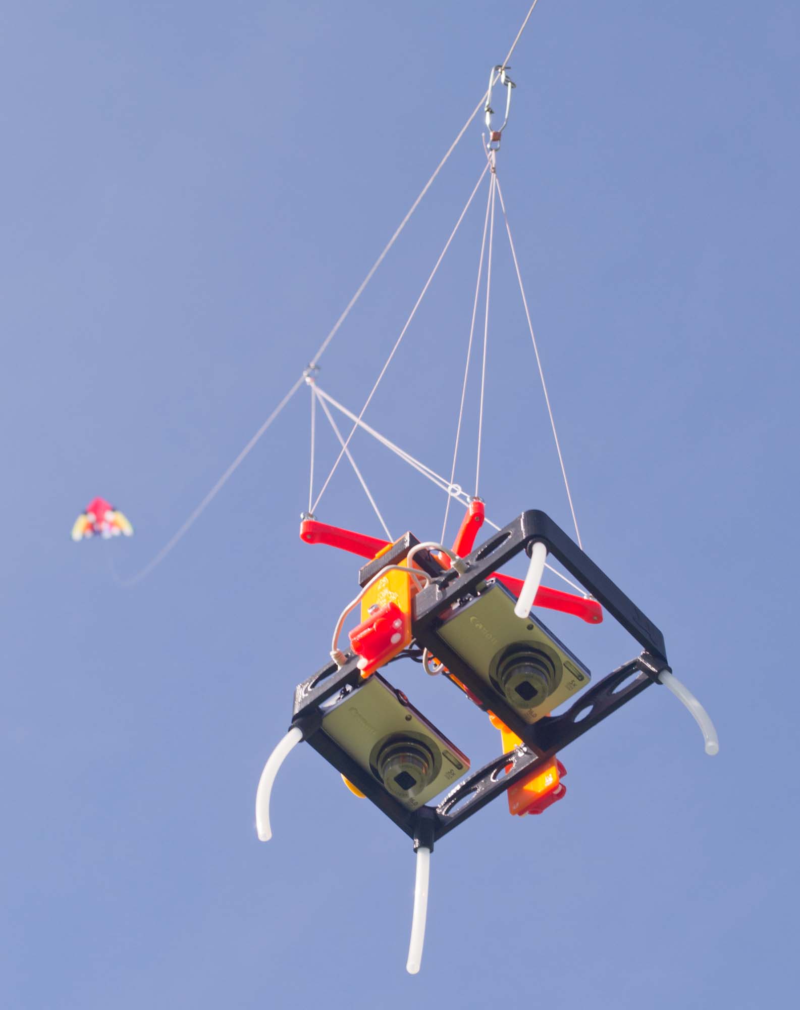
These lightweight rigs hold small cameras (e.g., Canon PowerShots) for lofting by kites or balloons. Vertical photos can be taken at intervals as the rig is moved around a property and high resolution orthophotos can be made by stitching together multiple photos. Normal and/or near infrared photos can be taken, and plant health indices such as NDVI (normalized difference vegetation index) can be derived from the photos. Recent, high resolution aerial images can help in documenting land status, tracking changes, and making planning or management decisions.
The rigs are designed to be 3D printed, and the 3D models are open source and available for free download on Thingiverse.
The rigs are designed to be 3D printed, and the 3D models are open source and available for free download on Thingiverse.
Image
Bill of materials
Parts lists for several aerial rig designs are here: http://kaptery.com/guides/
Other tools needed to build this tool
The rig frames are 3D printed. Models for printing are available for free download at Thingiverse and linked from here: http://kaptery.com/guides/
Step-by-step build instructions
Detailed assembly instructions for each rig are available here: http://kaptery.com/guides/
Supporting materials
ie. SketchUp files, CAD drawings, photos, video, technical drawings.